Enter your leaderboard nickname and email to join the competition or close this window to classify images without joining the competition.
Before you start...


Examples

FAQs
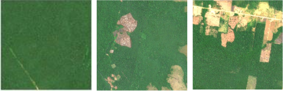
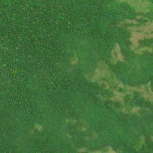
How much land is shown in each image?
Each of the nine regions is a 3-kilometer square. So, the entire image shows 81 square kilometers (or, approximately, 31 square miles or 20,000 acres).
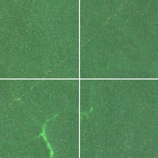
Why is the image divided into 9 regions?
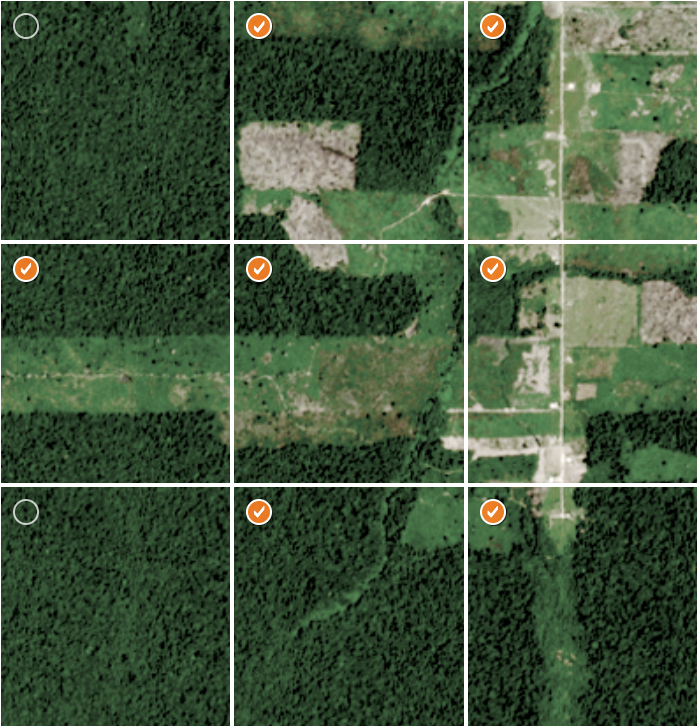
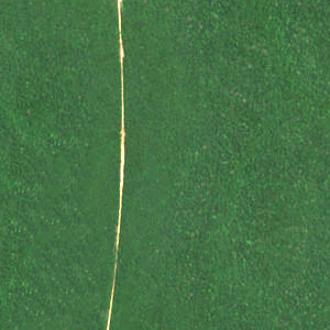
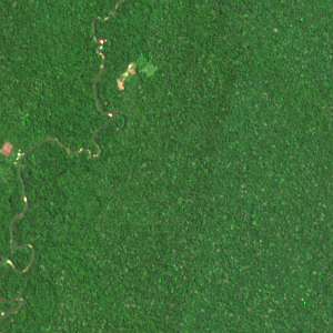
True Confessions! We’re actually showing you nine contiguous images. They’re shown together because they provide what can be much-needed context for one another. For example, you might wonder if what you’re seeing in this image is a part of a road or river or clearing:
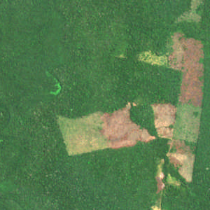
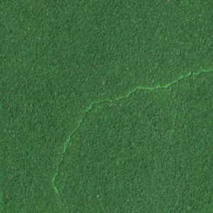
But, when seen in the context of adjacent land, the classification becomes obvious:
Where did the images come from? How current are they?
Get from Ian – Doesn’t matter how current – still trains the model.
Why is it important to identify human impact on the Amazon rain forest?
Get from Susan’s friend’s organization.
How will the trained AI model be used to reduce deforestation?
Find out from IIASA
How does an AI model get more accurate?
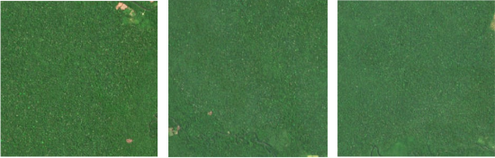
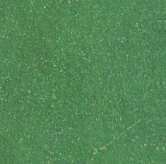
When the AI model initially assesses the satellite images, it classifies them as showing or not showing human impact. And it rates each classification with a degree of confidence.
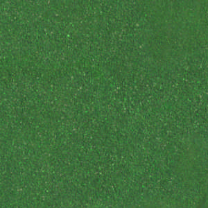
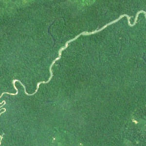
For example, the model classifies homogenous green images as showing no human impact, and does so with a high degree of confidence:

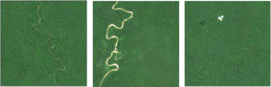
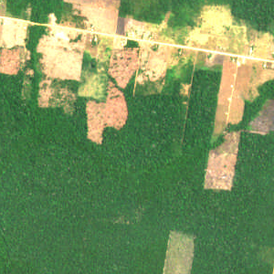
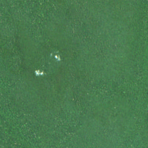
However, it classifies any visual interruption in the forest canopy as human impact – even a river – and it does that with a high degree of confidence, as well:
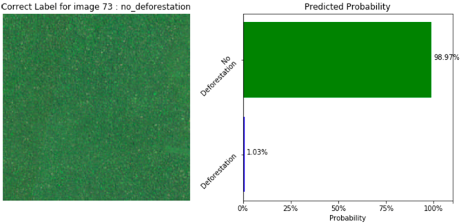
To train the model to correctly classify interruptions in the forest canopy as natural or human-made, it must be “fed” thousands of correctly-assessed examples. Using those examples as a reference, the model can more accurately classify visual interruptions in the forest canopy.
Am I really having an impact? How?
Yes, you are! Without you and the crowd, it would be logistically impossible for a small group of IIASA staff to classify thousands of ever-changing satellite images and continually improve the AI model’s accuracy.
What if I incorrectly assess an image?
Don’t worry! Every image will be seen and assessed by lots of people. So even if you mistook a road for a river, it’s likely that the majority of people will assess that image correctly. And the AI model won’t “use” that image to train itself until enough of the crowd have reached consensus on it.
I selected Submit before I finished looking at all the regions in the set. What can I do?
Just keep going. And don’t worry if you missed an image. The AI model won’t “use” that image to train itself until enough of the crowd have reached consensus on it.
After I select Submit, can I return to an image and change my classifications?
No. But don’t worry if you realize you incorrectly classified an image. The AI model won’t “use” that image to train itself until enough of the crowd have reached consensus on it.
How should I assess a region I’m not sure about?
Take your best guess. The AI model won’t “use” that image to train itself until enough of the crowd have reached consensus on it.
Thanks for your help so far!
Your participation is the first step in helping scientists develop an AI system that can detect subtle changes in the rainforest over time.
You just classified 38 images, which is the equivalent of 3078 square kilometers!
Whenever you’re ready, you can stop classifying images by closing the browser. But first, be sure to check out the crowd’s progress.
And, if you’re not ready to stop yet, feel free to continue classifying images!